Museum · Room 6

The estate from the air, 1995–2024

Aerial photographs and terrain relief: the palace, the gardens and the reservoir over thirty years.

Each document has its image, what it says in a few lines, the original passage and where it is kept. Quotations keep the spelling of the document.

Document image: Thirty years in four images

Click the image to enlarge.

1995–2023

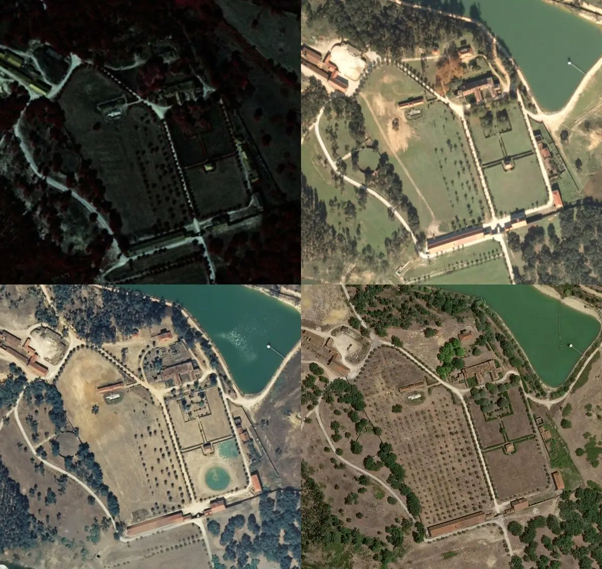
Thirty years in four images

The gardens south of the palace, with the circular basin at the centre, already had their present layout in 1995. The reservoir to the north-east does not exist in 1995 and appears in 2004–2006: it was built between those dates.
ProvenDireção-Geral do Território, orthophotos of 1995, 2004–2006, 2007 and 2023.

Document image: The palace roofs

Click the image to enlarge.

2004–2023

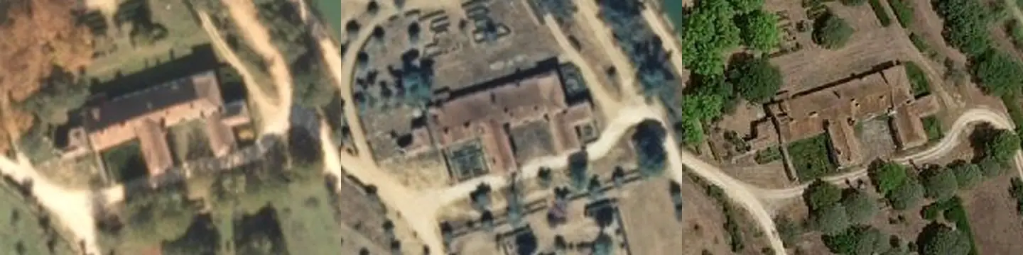
The palace roofs

The palace roof is complete in 2004 and 2007. In 2023 it has gaps in several places, which indicates that it began to collapse after 2007.

ProbableDireção-Geral do Território, orthophotos of 2004–2006, 2007 and 2023.

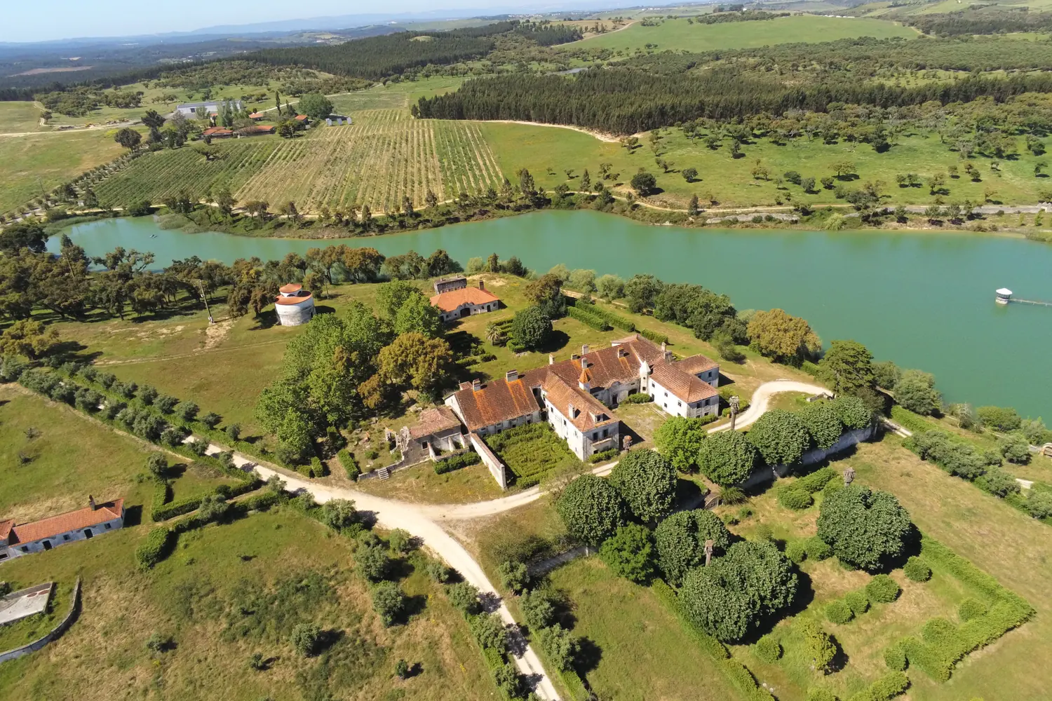
Document image: The palace, the gardens and the reservoir

Click the image to enlarge.

2019

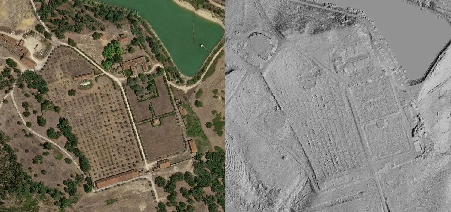
The palace, the gardens and the reservoir

Aerial photograph of May 2019: the palace at the centre, the terraced gardens, the dovecote and the reservoir.

ProvenPhotograph by Herdade da Torre Bela, May 2019.

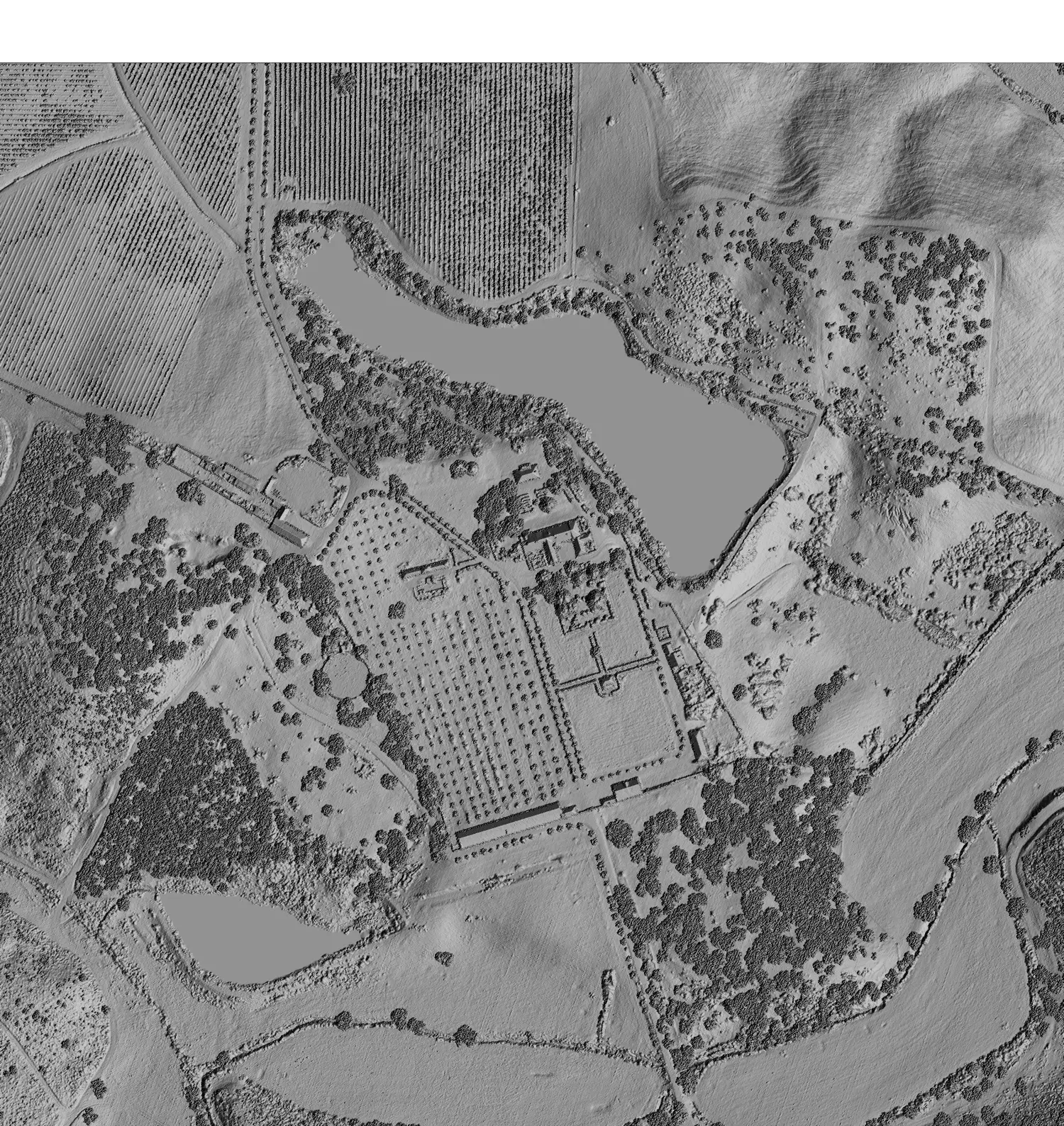
Document image: The relief of the landDocument image: The relief of the land

Click the image to enlarge.

2024

The relief of the land

The 2024 LiDAR survey measures the ground at 50-centimetre intervals. The shaded relief shows the buildings, walls, paths and garden terraces.

ProvenDireção-Geral do Território, LiDAR 2024 (50 cm).

Discover also

Quinta do Convento de Nossa Senhora da Visitação

Serra do Montejunto · Country House · Events · Wines Visit Website

This site uses no advertising or analytics cookies. Videos use YouTube privacy-enhanced mode.